 Closest Canadian Metropolitan Cities:
Location: Calgary, Alberta (Southern approach through Ft. McLeod)
Distance: 358 km / 222 miles
To Starting Destination Town on Loop: Creston, British Columbia
Driving Directions: From Calgary travel 168 km south on Hwy 2 to Ft. McLeod, turn west on Hwy 3 (the Crowsnest Highway) and follow for 153 km to Fernie. Remain on Hwy 3 for 93 km to Cranbrook, turning south on Hwy 3/95. Travel 70 km through Yahk to the junction of Hwy 3 & 95, 3 km south of Yahk, turning west on Hwy 3 and travel 39 km to Creston. International airport, car and RV rental available in Calgary.
Location: Calgary, Alberta (Western approach through Banff National Park)
Distance: 651 km / 404 miles
To Starting Destination Town on Loop: Nelson, British Columbia
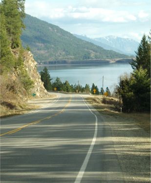
Driving Directions: From Calgary travel west on Trans Canada Highway 1 for 138 km to Banff, Alberta. Stay on Hwy 1 and follow through Banff National Park and Yoho National Park for 127 km to Golden, BC. You will not need to purchase a park pass unless you intend to stop while traveling through the park. Continue following Hwy 1 west 148 km to Revelstoke. Between Golden and Revelstoke the route takes you through Glacier National Park and Mt. Revelstoke National Park. Turn south at Revelstoke onto Hwy 23 along Upper Arrow Lake for 49 km to Shelter Bay. Cross Arrow Lake on a free ferry to Galena Bay and continue south on Hwy 23 for 49 km to Nakusp. Take Hwy 6 south and follow for 47 km to New Denver. New Denver is on the Selkirk Loop Map and is part of the North Kootenay Lake – Silvery Slocan Super Side Trip. Continue south on Hwy 6 along Slocan Lake for 79 km to the junction of Hwy 6 and 3A. Turn east and travel 14 km to Nelson.
Location: Kelowna, British Columbia
Distance: 340 km / 211 mi.
To Starting Destination Town on Loop: Castlegar, British Columbia
Driving Directions: From Kelowna follow Hwy 97 south 125 km to Osoyoos to the junction with Hwy 3. Turn east onto Hwy 3 and follow for 215 km to Castlegar. Castlegar is on the Selkirk Loop Map and is part of the Rivers, Dams & Mines Super Side Trip. There is an International Airport at Kelowna with car & RV rentals available.
**Note: Castlegar also has an airport that handles commuter jets, however it quite often experiences foggy conditions when planes are rerouted. Check on conditions before flying into Castlegar.
Closest US Metropolitan Cities:
Location: Spokane, Washington (closest International Airport )
Distance: 47 miles
To Starting Destination Town on Loop: Newport, Washington
Driving Directions: From Interstate 90 in Spokane, take Exit 281 for U.S. 2 / 395 North ( Division Street ). Travel north on Division Street / U.S. 2 for 6 miles to the U.S. 2 / 395 fork. Stay to the right on U.S. 2, travel northeast on U.S. 2 for 41 miles to Newport, where you can stop at the Newport Chamber Visitor Center & Depot Museum (on right hand side as you enter Newport) for orientation, maps, directions, etc. Total travel time from Spokane to Newport is approximately 1¼ hours. Spokane International Airport has car rentals available.
Location: Coeur d’Alene, Idaho
Distance: 48 miles
To Starting Destination Town on Loop: Sandpoint, Idaho
Driving Directions: From Interstate 90 in Coeur d’Alene, travel north on U.S. 95 for 48 miles to Sandpoint, Idaho. Stop at the Sandpoint Chamber of Commerce visitor center just north of town (right side of U.S. 95) for orientation, directions, maps, etc. Travel time from Coeur d’Alene to Sandpoint is approximately 45 minutes.
Location: Missoula, Montana
Distance: 191 miles
To Starting Destination Town on Loop: Sandpoint, Idaho
Driving Directions: From Missoula, travel west on Interstate 90 for 8 miles to Exit 96 for U.S. 93 / S.H. 200 North (To Kalispell / Glacier National Park). Travel north on U.S. 93 / S.H. 200 for 27 miles to Ravalli, then turn northwest on S.H. 200 for 123 miles through Thompson Falls along the scenic Clark Fork River to the Idaho border. Continue into Idaho on S.H. 200, which is the Pend Oreille National Scenic Byway, and a Selkirk Loop Super Side Trip. Travel west for 33 miles from the Idaho border along the north shore of Lake Pend Oreille to Sandpoint, where you enter the International Selkirk Loop. At the junction with U.S. 95, continue straight ahead (U.S. 95 South) toward downtown Sandpoint. The Chamber visitor center is about ½ mile ahead on your left (before you enter town). Travel time from Missoula to Sandpoint is approximately 3 hours. The Missoula airport has car rental available.